Waterfall Week – Big E bikes to Bridal Veil Falls, Provo Canyon, Utah

Do all parents beam with pride to see their oldest on a new bike? When I first told Big E I had a great surprise for him in the garage our conversation went something like this:

Big E – “Is it a sports thing?”
Me – “Yeah, I think you’ll love it!”
Big E – “A SPORTS THING? I wanted an angry birds toy surprise!” (yelling, crying and complaining ensue)

You can imagine how excited I was to bring it up again. Luckily a few days had passed and when Big E saw me putting the training wheels on his new bike his attitude suddenly became more amenable to trying this new sports thing.

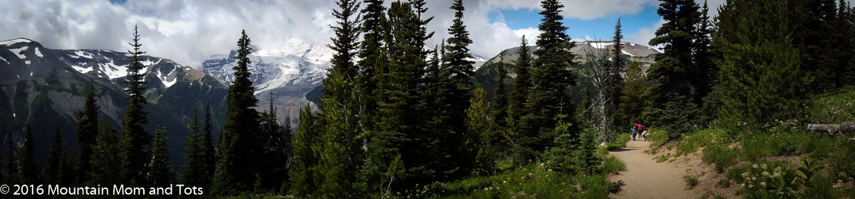
For his inaugural ride we went to our favorite family biking place – the Provo River Trail from Vivian Park to Bridal Veil Falls. The kids play while I unload bikes at Vivian Park, then the flat, paved trail follows the Provo river to the breathtaking Bridal Veil Falls.

The entire outing there and back takes a two hours or so, longer when your son is discovering the joy of back pedaling brakes for the first time. Even so, it’s a great way to spend an afternoon.

On this waterfall discovery adventure we fed fish, climbed rocks, and enjoyed a gatorade from the recently installed summertime snack bar. A special thank you goes out to the snack bar attendent, who overheard me telling Big E that I only had enough money for one gatorade, not gatorade AND fish food. The attendent offered Big E a plastic bag and told him he could pick up trash in exchange for a quarter’s worth of fish food, which Big E was more than happy to do.

Bridal Veil Falls is an impressive waterfall that the kids and I drive by several times each week. Rain, snow or shine it’s cascading levels are impressive, more so when you can stand beneath them and feel the spray on your face. It’s a great place for families to visit on a hot summer day with easy access for strollers, bikes or walkers.

After a long afternoon of riding, climbing, and feeding fish Big E decided he had enough of bike riding. The excursion ended with a rescue call to Mountain Dad, the two kids in the carrier and the new bike shoved in the back. Even so, it was a good time had by all.

Getting there: Take Provo Canyon Road (Hwy 189) north from Provo or 800 North from Orem into Provo Canyon. Bridal Veil Falls parking area is approximately ten miles up the road, Vivian Park another ten miles. Both parks are on your right.
Length: about 2 miles.
Difficulty: Easy – Biking on a flat, paved trail.
Tips: Don’t have a kids bike helmet? A kid’s ski helmet will do.

See these other posts about Bridal Veil Falls:
Bike Riding Adventure
An Advengtable!
Bridal Veil Falls Bike Ride
Bridal Veil Falls Summer Edition

Slickrock Bike Trail, Moab, Utah

The real title of this post should be: I don’t know what I’m doing but I’m trying it anyway. That’s how I felt riding my mountain bike on the practice loop of the famous Slickrock Bike Trail in Moab, Utah. The steep uphill sections interspersed with difficult turns and sandy sections made this more like a Bike Hike since I’m pretty sure I was walking my bike at least half of the time.

I’ve been mountain biking maybe twice before, but as an outdoorsy woman, I think mountain biking skills are good to have and where better to learn some than the Holy Land of mountain biking – Moab, Utah. The Slickrock Bike Trail is a 12 mile journey over well marked sandstone.

Lucky for me, the two mile practice loop gives a good taste of the whole trail, with technical dips and climbs, some sandy sections and a whole lot of beautiful scenery to enjoy. Don’t be fooled by my photo, fancy biking gloves do not make someone a mountain biker.

The most enjoyable part of the Slickrock Bike Trail was the amazing scenery. I took the short spur off the practice trail to Echo Canyon where I was lucky enough to see a bird flying below me. I don’t think I’ve seen the top of a bird in flight before. It was pretty cool.

I think I’d be ready to tackle the full loop after a few more trails on my mountain bike. For now I’m just glad I survived this tough trail.

Slickrock Bike Trail:
Getting there: From Moab’s main thouroghfare, turn left on 300 South, right when the road ends and then the second left onto Sand Flats Road following the signs for the Slickrock Bike Trail. About half a mile from the entry gate (where you pay a day use/camping fee) there is the Slickrock Bike Trail parking lot on the left.
Length: full loop 12 miles, practice loop 2 miles
Difficulty: Difficult
Tips: Bring extra water. It’s hot anyway, but huffing and puffing uphill made me extra thirsty.

For more info visit this awesome website – http://www.utahmountainbiking.com/trails/slickrck.htm

Hobble Creek Bike Trail, Springville, Utah

When Spring hits I’ll do almost anything to be outside. This is how I ended up towing 80 pounds of kids and cart behind my bike on a family bike trip last week. I have great memories of biking as a family growing up, and although I rarely do it now as a mom (maybe a few times a year) I still connect biking with happy memories.
Hobble Creek paved bike trail in Springville, Utah is a great family trail. It is paved, fairly flat, and passes some beautiful scenery. Although the leaves weren’t yet out on the trees, it was still a fun afternoon and we had the trail to ourselves.

Little g was dressed to impress with her purple crown and blanket cape (we’ve been going through a Frozen obsession at our house). At five years old I know Big E should have his own bike, but that’s one outdoors purchase I haven’t gotten around to yet. Sorry, I’m not VeloMom, but I know we’ll be looking into that this summer. He had so much fun on the Hobble Creek Bike Trail, we’ll have to get him his own wheels.

Trail Info:
Difficulty: Easy, except for one steep section around mile 3
Length: 4.5 miles each way
Time: 2 hours, including walking breaks
To Get There: Take the 400 South Springville Exit from I-15 and head east toward the mountains. As you climb the hill you reach a 4-way stop, turn Right. The road will curve eastward again and you’ll soon notice the sidewalk on the right is wider than before. This is the start of the trail in the residential area, but there are several other parking places 1/4 to 1/2 mile down the road that are more woodsy.

Rustler’s Loop, Fruita Colorado

Fruita, Colorado may not be well known in most circles, but to mountain bikers it’s a veritable Mecca. I’m slightly ashamed to admit that I have very little experience mountain biking, being a Mountain Mom after all. Lucky for you readers, that shame led to me try it out on my recent trip to mountain bike paradise.

The tots and I were in Fruita to visit an old friend, author Renee Collins. Her debut novel, Relic, was inspired by the local landscape – juniper bushes, desolate red rock and dry Colorado washes.

Renee took me on what she described as a beginner’s mountain biking trail. I would describe Rustler’s Loop as an expert route compared to the flat, paved, traffic free bike path I am used to riding. Rattling along rocky ruts and puffing up steep inclines, was difficult but surprisingly fun.

Rustler’s Loop started out with an intimidating incline, that I only rode for about twenty feet. The rest of the way uphill was me pushing my borrowed bike and wondering what I had gotten myself into. After that rocky start, the single track trail meanders over the plauteau, offering beautiful views of the Colorado River and Colorado National Monument across the way.

Sign posts along the trail and Renee’s coaching helped give me confidence on the bumpy, rock strewn path. I was glad someone was there to remind me, “Don’t panic and squeeze your brakes too hard downhill” and “Keep your speed up in this area, you’ll need it in the uphill section that follows.” Once I got past the fear of destroying the borrowed bike on the rocky road, I became more comfortable with pedaling and steering and even hit this amazing section of road!

The whole 3.5 mile trail only took about an hour, and I had so much fun I’m ready to do it again. It was a blast!

For directions to the trailhead click here.

Rustlers Loop
Length: 3.5 miles
Time: about 1 hour
Elevation Change: about 300 feet
Tips: Signs along the trail help beginners like me know what’s coming next.