Rustler’s Loop, Fruita Colorado

Fruita, Colorado may not be well known in most circles, but to mountain bikers it’s a veritable Mecca. I’m slightly ashamed to admit that I have very little experience mountain biking, being a Mountain Mom after all. Lucky for you readers, that shame led to me try it out on my recent trip to mountain bike paradise.

The tots and I were in Fruita to visit an old friend, author Renee Collins. Her debut novel, Relic, was inspired by the local landscape – juniper bushes, desolate red rock and dry Colorado washes.

Renee took me on what she described as a beginner’s mountain biking trail. I would describe Rustler’s Loop as an expert route compared to the flat, paved, traffic free bike path I am used to riding. Rattling along rocky ruts and puffing up steep inclines, was difficult but surprisingly fun.

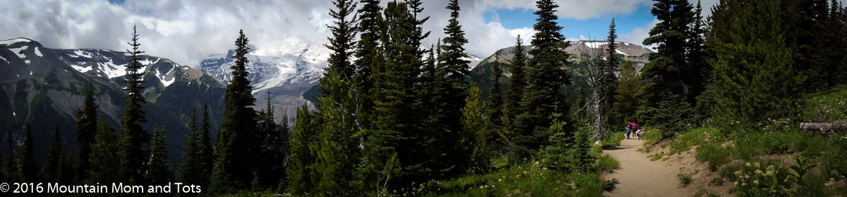
Rustler’s Loop started out with an intimidating incline, that I only rode for about twenty feet. The rest of the way uphill was me pushing my borrowed bike and wondering what I had gotten myself into. After that rocky start, the single track trail meanders over the plauteau, offering beautiful views of the Colorado River and Colorado National Monument across the way.

Sign posts along the trail and Renee’s coaching helped give me confidence on the bumpy, rock strewn path. I was glad someone was there to remind me, “Don’t panic and squeeze your brakes too hard downhill” and “Keep your speed up in this area, you’ll need it in the uphill section that follows.” Once I got past the fear of destroying the borrowed bike on the rocky road, I became more comfortable with pedaling and steering and even hit this amazing section of road!

The whole 3.5 mile trail only took about an hour, and I had so much fun I’m ready to do it again. It was a blast!

For directions to the trailhead click here.

Rustlers Loop
Length: 3.5 miles
Time: about 1 hour
Elevation Change: about 300 feet
Tips: Signs along the trail help beginners like me know what’s coming next.

Coke Ovens Overlook Trail, Colorado National Monument, Colorado

On our recent visit to Colorado National Monument, the tots and I explored the Coke Ovens Trail along with an old friend, author Renee Collins, and her daughter. The trail is about 0.75 mile round trip, and was relatively easy, the only rough spot being some switchbacks just after the Upper Monument Canyon trail head.

Coke Ovens Overlook Trail connects with several other trails in the Colorado National Monument system. Along the way, Big E pretended to be a jedi, randomly making light saber sounds toward juniper trees, rock cairns and his sister. We chose this trail because it was short, relatively flat and featured a fenced off viewing area at the end, where the tots could all climb and play two year old hide and seek in safety.

The quick descent featured several sharp switchbacks, which I knew would be tough on the way back up, but were fun on the way down. The view was amazing with red rock and juniper as far as the eye could see. Everything was great until we tried hiking back out.

Little g hated being wrestled into the hiking pack, but since nap time was rapidly approaching, I knew hiking uphill would only be miserable if she tried to walk on her own. I wasn’t expecting Big E, my normally avid trekker, to make such a fuss about the hike out either. Every curve of the trail brought more complaints.

“Why aren’t we there yet? Where’s the car? I’m tired. Carry me mom.” When we left for the trail I had expected good exercise, beautiful views and a little fun. I hadn’t expected to slog uphill for ten minutes to a chorus of complaints.

Luckily the hike ended quickly and we all went out for lunch to celebrate. We needed it.

Coke Ovens Overlook Trail
Length: 0.75 mile
Time: 1 hour 15 minutes
Tips: Don’t go with cranky kids.

Otto’s Trail, Colorado National Monument, Colorado

Colorado National Monument rises above the cities of Fruita and Grand Junction, Colorado, a plateau above the plains. Rim Rock road winds through the monument, passing beautiful rock formations on every side. The entire 23 mile loop is popular with cyclists, but my tots and I weren’t there to ride – we wanted to hike.

I was impressed with the number of kid friendly hiking options (short and flat) in Colorado National Monument. The first trail we chose was just one mile east of the Visitor’s Center. Otto’s Trail is a fun, quick hike to a beautiful overlook area of Pipe Organ and Independence Monument rock formations. My tots and I were there along with my old friend and author Renee Collins. The wild west setting in her debut novel Relic was inspired by the desolate beauty of Colorado National Monument.

The hike was only half a mile there and back. The only difficult part of the trail was that near the overlook area, if you or your tots stray too far off the trail you’ll drop off a cliff and plummet dangerously to the rocks below, you are walking on the top of a plateau after all.

When we reached that area, Big E refused to hold my hand, of course, but instead of tying him to me, like I wanted to do, I tried to trust that my four year old would know enough to stay away from the edge. Little g was more easily managed since I could pick her up and haul her myself.

Otto’s Trail in Colorado National Monument was fun, quick and relatively painless. Plus the views at the end were amazing.

Otto’s Trail Info:
Length: 0.5 miles round trip
Time: 45 minutes, less without tots
Tips: Don’t let your kids fall off the edge.

Bristlecone Pine Loop, Bryce Canyon National Park, Utah

Two things come to mind when I think of Bryce Canyon National Park – High altitude pine forests and red rock hoodoo formations. The Bristlecone Pine Loop incorporates both. Starting at over 9000 ft elevation, the trail winds through ancient forests of pine and spruce trees to beautiful overlook areas where hoodoos can be seen for several miles. 
Big E didn’t want to go on a hike, he wanted to have a picnic. Instead of coercing him, it just took us more than a mile to find the picnic area. Luckily, Big E was interested in pine cones, chipmunks and hoodoos enough that he wasn’t constantly asking where the picnic tables were. Little g fell asleep in the car and Mountain Dad soon snoozed off with her. 

Bristlecone Pine Loop trailhead is located at the Rainbow Point Parking Area in Bryce Canyon National Park, literally the last stop on the road. I chose the hike after reading the book 50 Best Short Hikes in Utah’s National Parks by Ron Adkison. In general the book has great short hike suggestions and trail info, but the author using ‘we’ verbs throughout the descriptions really got on my nerves. WE will not be returning via the right fork, Ron. I will be returning with my son.
The hike was easy, fun, and beautiful, plus it’s part of the Parks’ Hike the Hoodoos program, where Junior Rangers can get a special prize for hiking up to three miles within the park. Just bring photos or rubbings of three different sign medallions to the visitor center.
Bristlecone Pine Loop
Distance: 1 mile round trip
Time: one hour
Difficulty: Easy, relatively flat terrain. Interpretive signs gave Big E and me plenty of things to think about along the way.
Tips: Big E found the picnic area on the east side of the parking lot, just south of the trail head.